


GIS IN FORESTRY: ADVANCING SUSTAINABLE FOREST MANAGEMENT
Vandita, Kumud Dubey and Mansi Pandey
Geographic Information Systems (GIS) are computer-based tools that store, analyze, and visualize spatial and geographic data. These systems integrate various datasets, including satellite imagery, topographic maps, and field survey data, to provide comprehensive spatial analysis. GIS enables users to understand patterns, relationships, and trends in geographic space, making it an essential technology in multiple disciplines, including forestry.
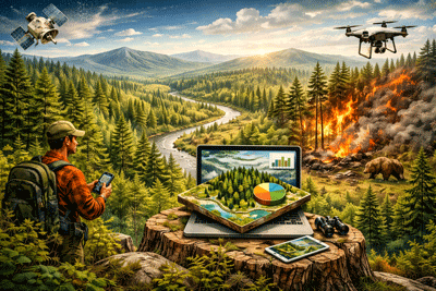
GIS has revolutionized forestry by providing powerful tools for spatial analysis, mapping, and decision-making. As the global emphasis on sustainable forest management increases, GIS has emerged as an indispensable technology for monitoring, analyzing, and managing forest resources. By integrating diverse data sources, GIS allows researchers to track changes in forest cover, assess biodiversity, and optimize resource management strategies. This article explores the applications, benefits, and future prospects of GIS in forestry.
Applications of GIS in Forestry:
1. Forest Mapping and Inventory
GIS enables accurate mapping of forest landscapes by integrating remote sensing data with ground surveys. This facilitates the creation of detailed forest inventories that include information on tree species, canopy cover, and biomass. Advanced GIS tools allow foresters to analyze forest composition and distribution at various spatial scales.
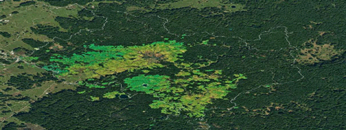
2. Deforestation and Land-Use Change Monitoring
Deforestation is a critical global issue, and GIS plays a crucial role in tracking forest loss. By comparing satellite imagery over time, GIS helps detect changes in forest cover, identifying areas affected by illegal logging, agriculture expansion, or urbanization. This information supports policymakers in implementing conservation measures.
3. Forest Carbon Sequestration and Climate Change Mitigation
Forests act as carbon sinks, playing a crucial role in mitigating climate change. GIS helps in estimating carbon stocks by analyzing vegetation density and biomass distribution. This information is vital for carbon credit programs, sustainable forest management policies, and climate change mitigation efforts.

4. Wildfire Management and Risk Assessment
GIS aids in wildfire risk assessment by integrating data on temperature, humidity, wind patterns, and fuel load. Fire managers use GIS-based models to predict fire spread, optimize firefighting strategies, and assess post-fire recovery. This helps in reducing the impact of wildfires on ecosystems and human settlements.

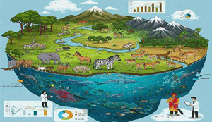
5. Biodiversity Conservation and Wildlife Habitat Analysis
Conserving biodiversity requires a deep understanding of species distribution and habitat conditions. GIS supports wildlife habitat modelling by analyzing terrain, vegetation types, and water sources. Conservationists use GIS to identify critical habitats, design protected areas, and plan ecological corridors for wildlife movement.
6. Forest Road Planning and Management
Efficient transportation networks within forests are essential for timber extraction and fire suppression. GIS assists in designing optimal road networks by considering factors such as topography, soil stability, and environmental impact. Sustainable road planning minimizes habitat fragmentation and soil erosion.
7. Wildlife Management
In many facets of habitat suitability analysis, forest management, and conservation, RS and GIS have grown in importance. These tools make it easier to map and track the condition of the vegetation in national parks and wildlife sanctuaries, evaluate the success of conservation initiatives, and examine ecological trends and encroachment into areas designated for protected animals. Additionally, GIS facilitates carrying capacity assessments, management plan development and implementation, and animal and marine population monitoring.
Benefits of GIS in Forestry
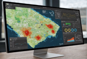
- Enhanced Decision-Making: GIS provides real-time data and analytical tools that improve decision-making for forest managers, policymakers, and conservationists.
- Improved Efficiency and Cost Reduction: GIS automates data processing and analysis, reducing the time and costs associated with traditional forest surveys.
- Precision Forestry: GIS enables site-specific forest management practices, leading to optimized resource utilization and reduced environmental impact.
- Data Integration and Visualization: GIS combines various datasets, including remote sensing imagery, topographic maps, and climate models, allowing comprehensive forest analysis.
- Public Awareness and Engagement: GIS-powered interactive maps help educate the public and stakeholders about forest conservation and sustainable management initiatives.
Future Prospects of GIS in Forestry
GIS has become an integral tool in modern forestry, facilitating sustainable forest management through precise mapping, monitoring, and analysis. As technology continues to evolve, GIS will play an even greater role in addressing global forestry challenges, ensuring the conservation and sustainable use of forest resources for future generations. Al-driven GIS models can predict forest growth, detect pests and diseases, and automate data analysis. The integration of GIS with unmanned aerial vehicles (UAVs) is improving real-time forest monitoring. Additionally, open-access GIS platforms are making the data processing easily accessible, enabling wider participation in forest conservation efforts.


Authors:
1. PhD Scholar (UGC-JRF) Senior Scientist PhD Scholar (UGC-JRF)
2. Forest Research Institute, Dehradun (ICFRE-ERC, Prayagraj)
3. Indian Council of Forestry Research and Education Eco- Rehabilitation Centre (ICFRE-ERC), Prayagraj, UP